The miner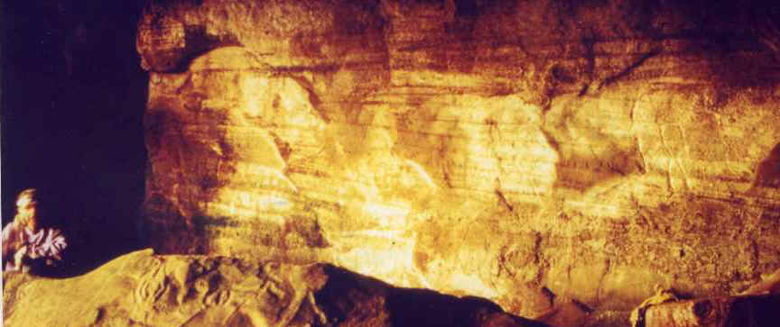 ls
ls 
On the ocean ,In the winter cave there is a shear in the sand stone. The dome with the
petorglyphs carved in it are part of it. It heads north to a wall in the back of the
cave here the vein has large calcite crystals on the wall .
All through the sand stone out side the cave is anthracite coal.
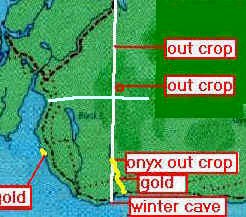
The vein runs north and cuts across the geo thermal area till it crosses the first
creek, here it has turned to a [onyx out crop] of quartz feldspar [felsite] and this is
where the gemstones and gold enter the creek.
 there
is architectural grade granite on one side of the shere and A mound of Quartzite on the
other side.
there
is architectural grade granite on one side of the shere and A mound of Quartzite on the
other side.
It now appears there are a series if parallel sheres.
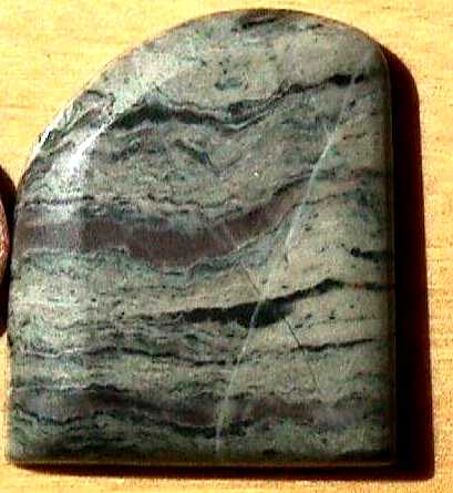
This gem stone was cutt of the peice I am holding in my hand, follow link. If its the
stone I think it is, Its very valuable, its also for sale.
The vein passes under Willis pools and again appears in
the next creek [see video] , here it has turned to a
pophery dyke.
At the top of the mountain were the crater is the
vein is intercepted by another vein ,hoskins vein. see page 5
Above the dyke is the spot hoskins vein would cross the crator and
this is the old crystal quary willy spoke about.
 - The vein's cuts through ,Architectural grade granites . a geo
thermoial area,
- The vein's cuts through ,Architectural grade granites . a geo
thermoial area, 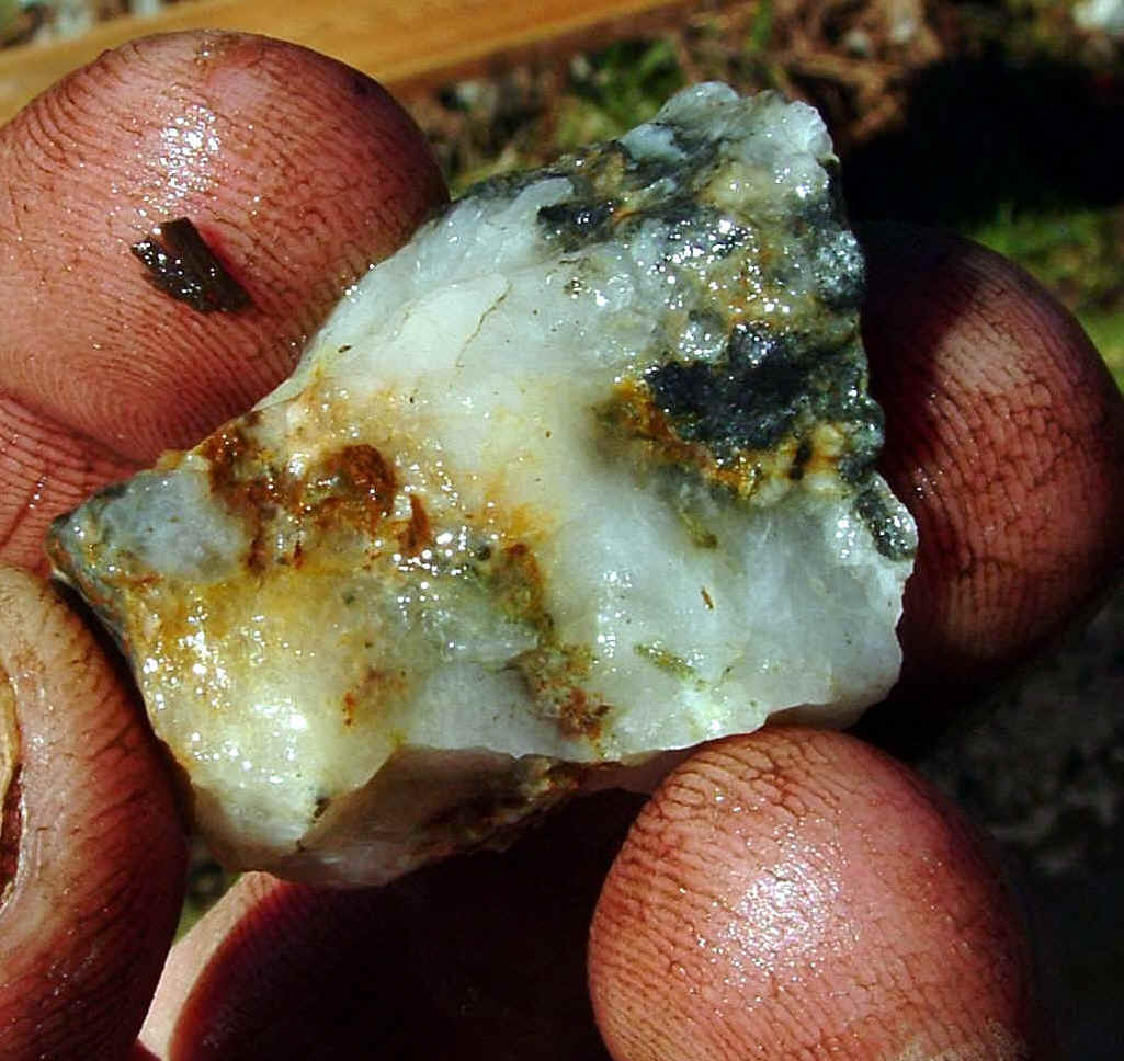
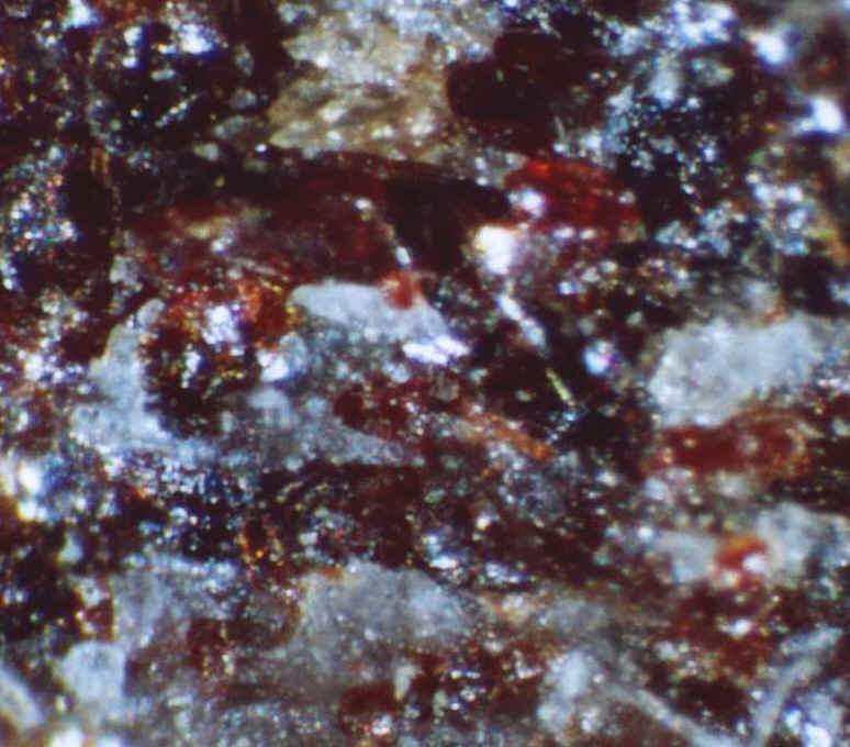
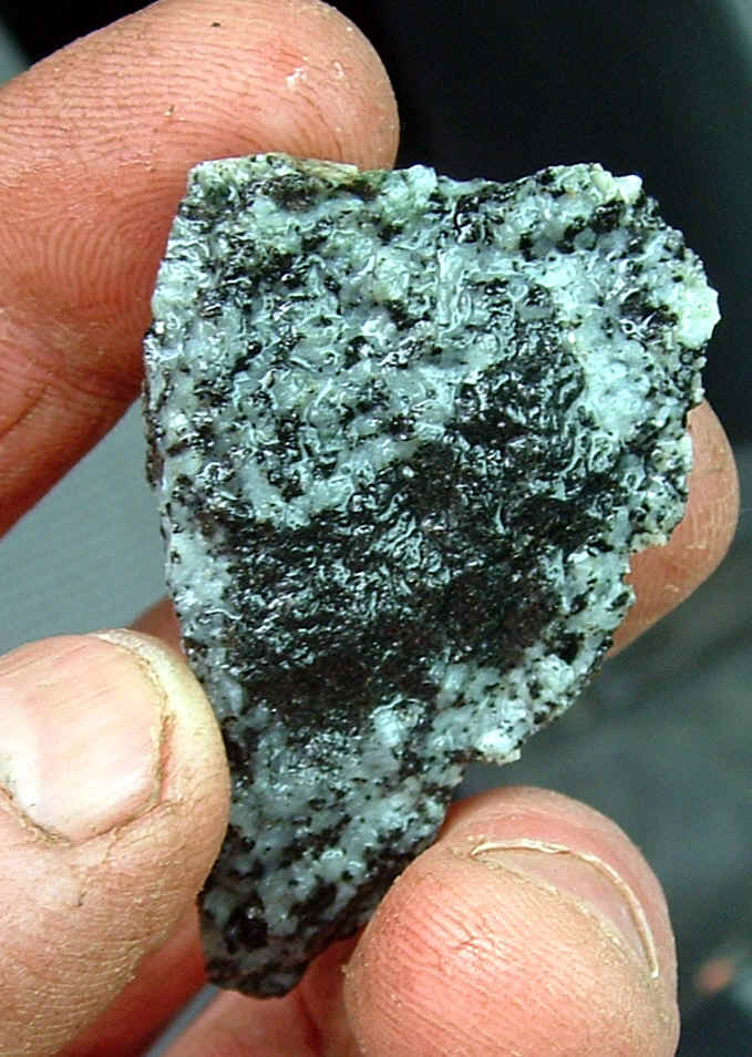
made up of Skarn , and calchol pyrites. The water enters the vein under the pools at
the top of the black lake creek and the machingan. the pressure builds up under and it
comes out of on the down side of the quartzite.
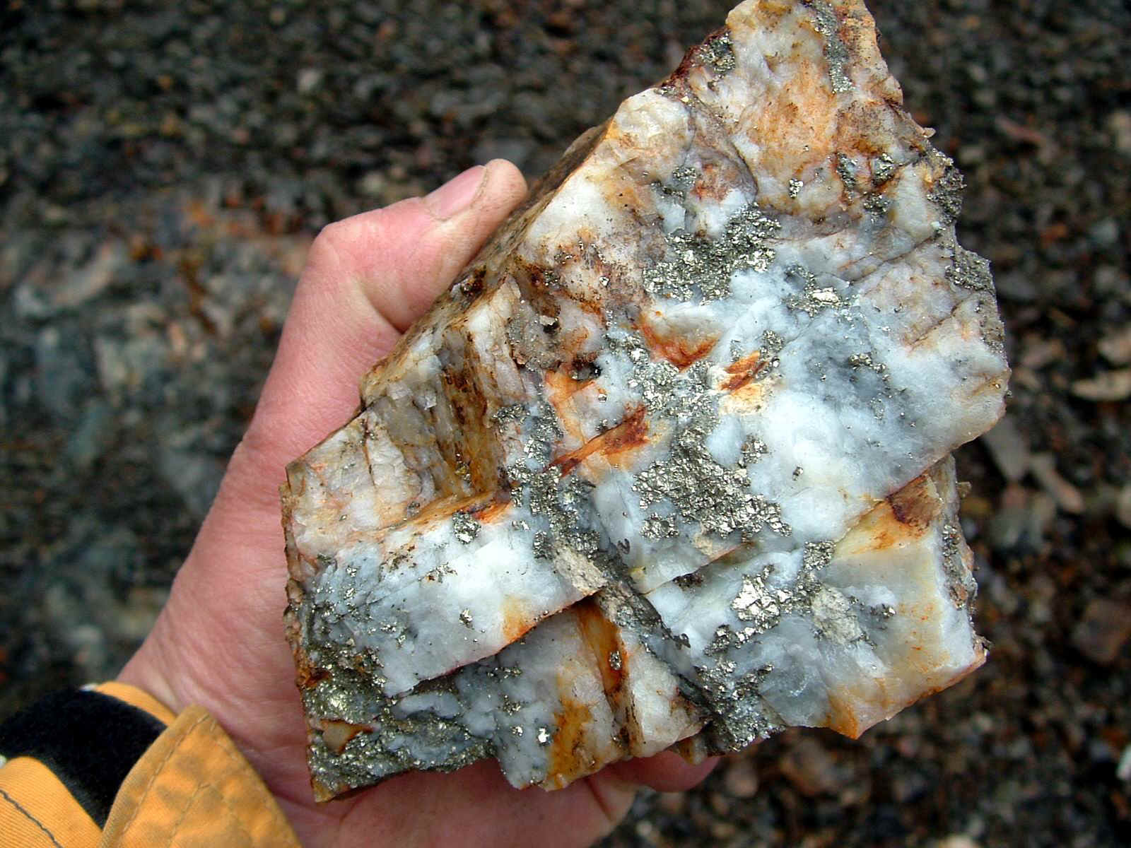
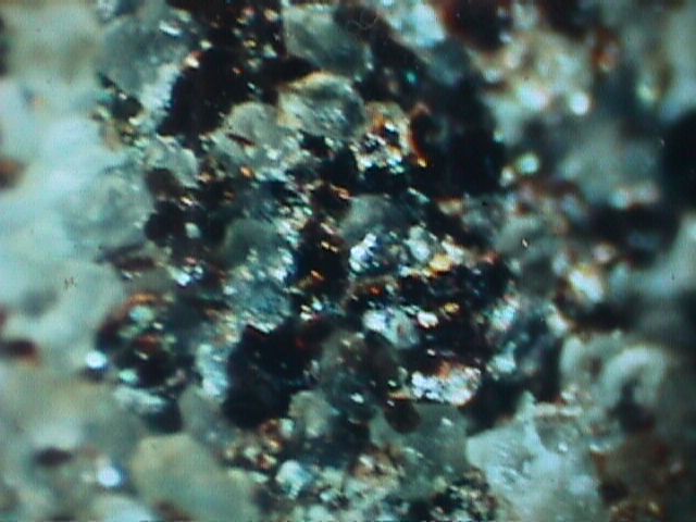 this ptciture shows the make up of the rock in this pitt and as you
can see the rock is made up of quartz crystles and what looks like garnite.
this ptciture shows the make up of the rock in this pitt and as you
can see the rock is made up of quartz crystles and what looks like garnite.
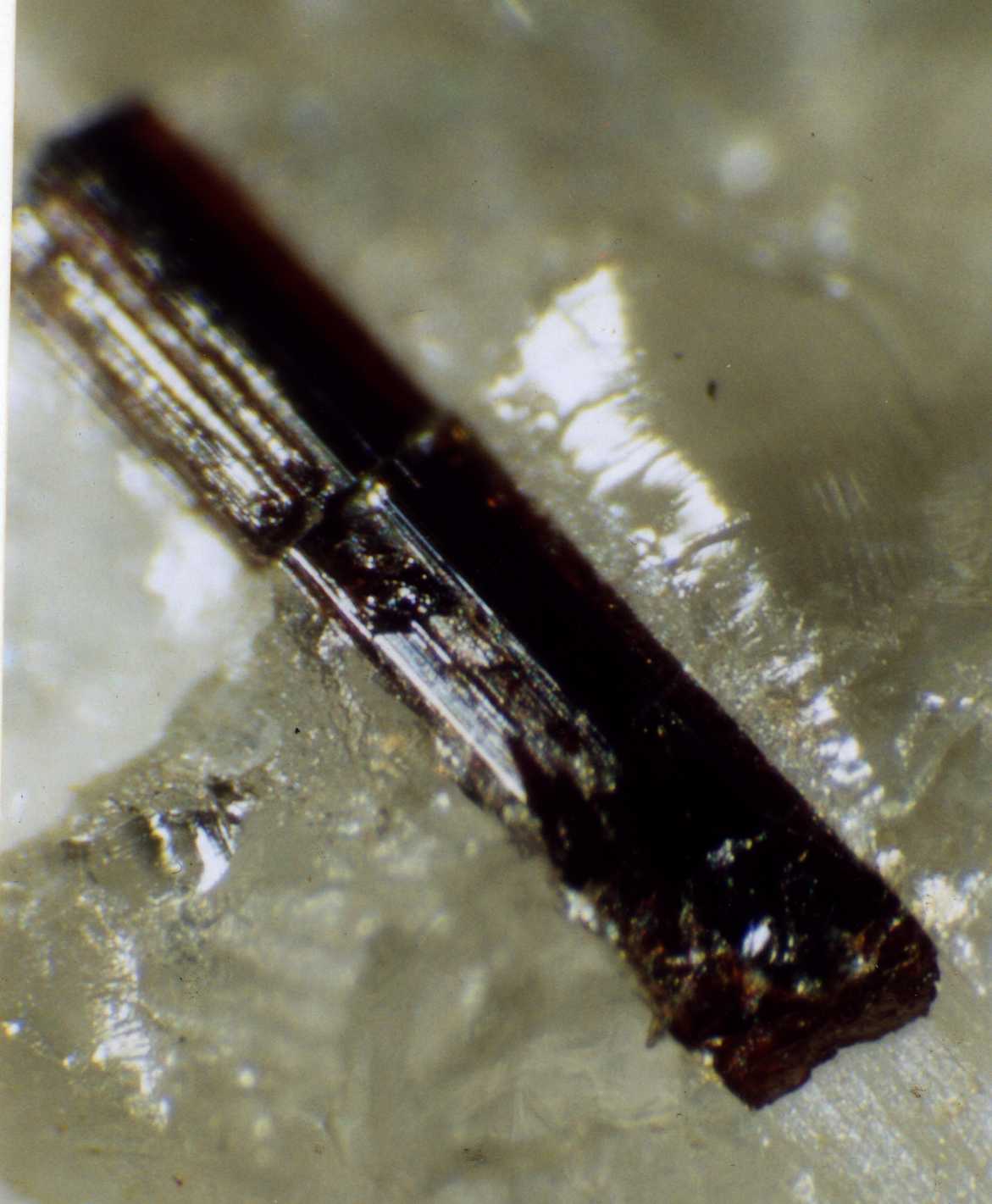
 the vein
appears to
the vein
appears to
have a pyrope garnet and olivene in it as well. With saphire in the placer this crystle
could be cronundrom.
 after the vein leaves the mountain
it travels across to the base of the mounmtain here it
crosses a gorge were it is clearly visible.
after the vein leaves the mountain
it travels across to the base of the mounmtain here it
crosses a gorge were it is clearly visible.  From here it travels across the flats were it is clearly
visisble in a rock pitt, here the vein is quartz with chalchol pyraite in it.
From here it travels across the flats were it is clearly
visisble in a rock pitt, here the vein is quartz with chalchol pyraite in it.
between the beach gold and the creek is this pit ,the pit has been buried by logs, burying the quartz[13]
[no picutre yet].
To see the pitt now nov 05 follow the quartz [13] link.
Its April 2 and today we went to see the pit, when they first made it around 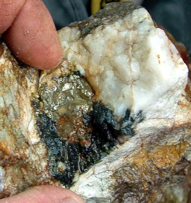 1999 we knew they buried it on purposes,
Hiding the ore. You cant miss the fools gold.
1999 we knew they buried it on purposes,
Hiding the ore. You cant miss the fools gold.
 You know, Fools
gold is called that because only a fool will walk by it..
You know, Fools
gold is called that because only a fool will walk by it..
Bull quartz and chalchopyrite, that's what you look for.>>
I knew the logging company did a bunch of logging and re opened the pit. Last year in
march, I was told someone opened a mine in the area, It was just a roomer.
I was quite excited to see it. Given the pit is on the claim and is on the edge of
the quartzite mound were it turns to the grano diorite.
Follow this link to the April 2 trip to the pitt.
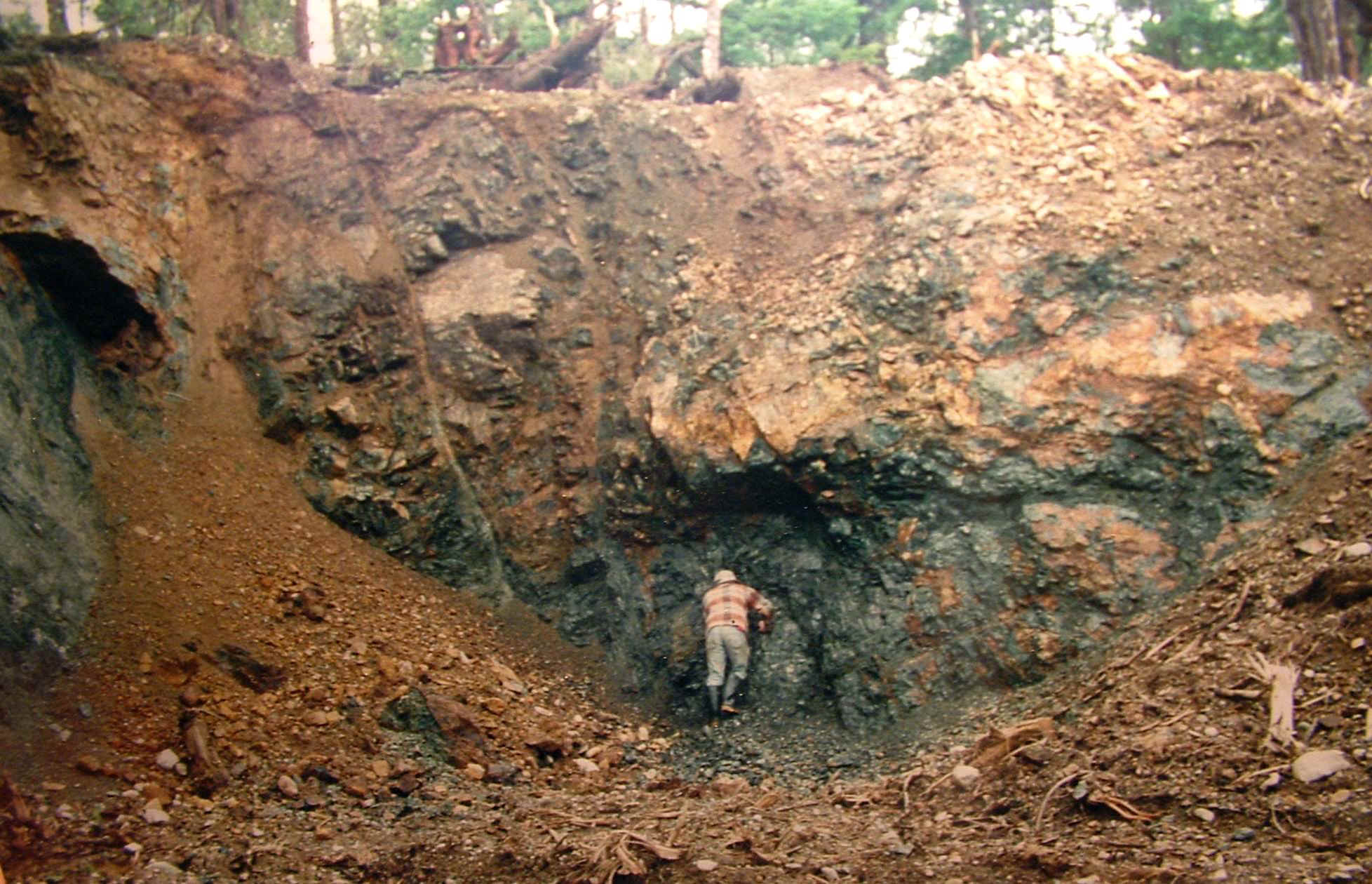
What a surprise when we got there, the pit was very well done, nice ore boulders lining
the pit over looking the vast pacific ocean.
About 1,000 meters east ,in the creek draw, we dug this hole. Its down stream
from where the vein hits the creek. This would be were the Spanish [Indian gold] mine
should be. 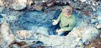

The ground is blue just below the surface and to find the placer gold you would have to
get below this blue ground to bed rock.[13a]
This whole water shed was once hidden under a thick blanket of west coast temperate rain
forest ,completely unlogged up until 5 years ago, when they started punching in roads, this gave us the chance to prospect in
places other then the creeks and the roads have exposed the vast mineral potential of this
mountain.
On to page 5


